Bilju Fm
Period:
Ediacaran
Age Interval:
Ediacaran ( ?? Ma)
Province:
NW Himalaya Kumaun-Garhwal Tethyan Himalaya
Type Locality and Naming
Reference section: Bilju Village Gori Ganga Valley, Pithoragarh, Kumaun Northwest Himalayan region. [Original Publication: Sinha, A.K., 1989. Geology of the Higher Central Himalaya. John Wiley and Sons, Chichester, U. K. 1–219.]
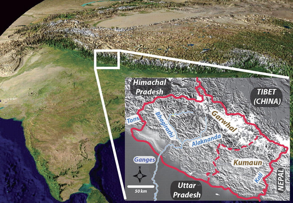
[Figure 1: Location of the Kumaun-Garhwal region (from Celerier et al., GSA Bull 2009)]
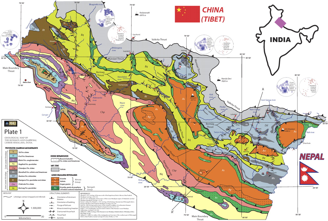
[Figure 2: Geologic map of the Kumaun-Garhwal region (from Celerier et al., GSA Bull 2009)]
Lithology and Thickness
Sandstone. Pyrite-rich dirty white quartzite with siltstone, slate and limestone lenses. 500m (approximately)
Lithology Pattern:
Clayey sandstone
Relationships and Distribution
Lower contact
Gradational contact with underlying the Rilkot Fm.
Upper contact
Conformably overlain by the Milam Fm.
Regional extent
Kumaun to Garhwal regions
GeoJSON
{"type":"Feature","geometry":{"type":"MultiPolygon","coordinates":[[[[78.73,31.7],[78.26,31.55],[77.84,31.52],[77.46,31.22],[77.11,31],[77.45,30.5],[78.13,30.46],[78.45,30.08],[78.96,29.85],[79.47,29.63],[79.85,29.06],[80.21,29.3],[80.41,29.85],[80.77,30.13],[80.59,30.43],[79.71,30.8],[79.11,31.3],[78.71,31.44],[78.73,31.7]]]]}}
Fossils
None
Age
Precambrian. Considering that it is conformable with overlying Cambrian Milam Fm, and "only" 500 m of sandstone, then for graphic purposes shown as upper Ediacaran.
Age Span:
Beginning stage:
Ediacaran
Fraction up in beginning stage:
0.7
Beginning date (Ma):
567.66
Ending stage:
Ediacaran
Fraction up in the ending stage:
1.0
Ending date (Ma):
538.80
Depositional setting
Depositional pattern:
Additional Information
Compiler:
Birendra Singh & O.N. Bhargava.

